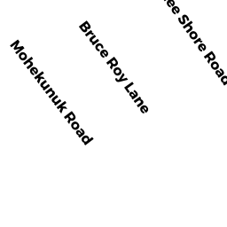
27 BRUCE ROY LANE
Owner Information
LOVISON BONITA J
27 BRUCE ROY LANE
BECKET, MA 01223


Property Details
27 BRUCE ROY LANE is classified as a Single Family Residential (Cp).
The primary structure on this property was built in 1986. There are 1,170ft2 of built area within this property. There is 1,170ft2 of residential/living space within this property. This property is listed as having 5 rooms.
27 BRUCE ROY LANE is valued at $180,700. The land is valued at $19,400 and the structures are valued at $161,300.
This property is in Zone R1. Confirm with local Zoning Board authorities to ensure there are no overlays or other easements on this property.
The most recent deed for 27 BRUCE ROY LANE is recorded at the local registrar in Book 1625, Page 303. 27 BRUCE ROY LANE was last sold on Monday, October 5, 1998 for $106,000.
Assessment data from fiscal year 2020.
Flood Data
According to the FEMA National Flood Hazard Layer, this property does not appear to be in a flood zone. It may also be in an area not yet reviewed. Nonetheless, confirm this information prior to taking any action.
To view the flood hazards around this property, create a FEMA "Firmette" Map of the area around 27 BRUCE ROY LANE.
Broadband Internet Providers
| Provider | Type | Bandwidth (mbps) | |
|---|---|---|---|
| Viasat Inc | Satellite | 35 | 3 |
| Whip City Fiber | Fiber | 1000 | 1000 |
| T-Mobile | Fixed Wireless | 25 | 3 |
| HughesNet | Satellite | 25 | 3 |
| GCI Communication Corp. | Satellite | 0 | 0 |
| VSAT Systems, LLC. | Satellite | 2 | 1 |
Broadband service provider data from December 2020.
Adjacent Properties
- 0 SHAWNEE SHORE ROAD
Potentially Developable Residential Land owned by TUOZZOLI ANGIE & THERESA - 13 BRUCE ROY LANE
Single Family Residential owned by STORTI CARL F & KATHERINE - 45 BRUCE ROY LANE
Single Family Residential owned by PETRONIS MICHAEL D - 0 SHAWNEE SHORE ROAD
Potentially Developable Residential Land owned by NIXON REGINA L & ANN M WILLIAMS